Countries/Territories

Updated 2021-01-12 18:58:07

The names of countries/territories of the world are taught in English and Chinese. This collection of precious dry lands that shares the whole mankind includes not only the world's independent countries, but also specific areas that are not a UNUnited Nations: We the peoples...A stronger UN for a better world. member. Please visit the table of male and female genders of country names in French.

In French, country names have their male and female gender. The majority of young countries have their name in male form just as Ouganda, Congo. But historical countries have their gender according to the termination of the word. La Chine is female as the majority of European Coutries except for Andorre, Chypre, Malte, Monaco, Saint-Marin, le Danemark, le Luxembourg, le Liechtenstein, le Monténégro. les Pays-Bas, le Portugal et le Vatican (cf. Noms Pays masculins féminins).

So the gender column will be presented as follows: ♂Male, ♀Female, Neutral.

Countries/locations    Close
World | Countries/Territories | Regions of China | Provinces of China | Regions in France | French Departments | States/Provinces | Cities/Towns | Locations | World Continents | French AOP Wines

1

id
Country
Country
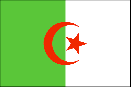
Algeria
Country in French
Algérie
countryucasefr
ALGERIE
Country in Chinese
Country in Spanish
Argelia
Country in Italian
L'Algeria
Country in Portuguese
Argélia
Country in Germain
Algerien
countrypy
a1 er2 ji2 li4 ya4
countrylocal
Al Jaza'ir
countryfull
Algeria
countrynm
Algeria
ISO2
DZ
ISO3
DZA
countrycodeisono
012
countrycodevehicle
DZ
countrycodeolympic
ALG
countrycodeirs
AG
countrycodeirsfr
AG
countrycodeirsmixt
AG
countrycode
213
♀Female
15
4
3
languagesfr
Arabe
124
currency
dinar
currencyfr
dinar algérien
currencyisocode
DZD
currencyisocodefull
DZD 012
currencypxcode
DZD
currencysymbol
DA
currencysubdivision
100 centimes
currencyregime
composite
currencyvalue
0.01397
nationality
Algerian
nationalityfr
Algérienne
Capital
Algiers
capitalfr
Alger
Phone Prefix
213
Area km2
2 381 740
arealand
2 381 740
landarablerate
0.0321
landforestrate
0.009
coastline
998
summit
Tahat 3 003 m.
boundarycountries
Maroc, Sahara occidental, Mali, Mauritanie, Niger, Libye, Tunisie.
timezonedeltabegin
1
flaglink
maplink
dzcolor.gif
outlinemaplink
dzout.gif
visapassenger
-1
maincities
Oran, Constantine, Annaba, Blida, Batna, Sétif
largestcity
Algiers
largestcitypopulation
3 705 000
rankpopulation
35
Population
31 833 000
rankgdp
50
gdp
66530000000
rankgdpppp
38
gdpppp
194389000000
rankgni
49
gni
61574000000
rankincomeorigin
112
rankincome
122
income
1930
rankincomeppp
103
incomeppp
5930
lifeexpectation
70.76
alphabetizationrate
0.574
natalityrate
0.02045
mortalityrate
0.00544
mortalityrateinfantile
0.0517
precipitation
686
nationalevent
Revolution Day
nationaleventfr
Jour de le Révolution
nationalholiday
1 November (1954)
Birthday yyyy-mm-dd
1954-11-01 00:00:00
1
7
location
Northern Africa, bordering the Mediterranean Sea, between Morocco and Tunisia
terrain
mostly high plateau and desert; some mountains; narrow, discontinuous coastal plain
naturalresources
petroleum, natural gas, iron ore, phosphates, uran
7
Web
rgbback
16777215
todate
1
Notes
Courageux peuple, le Cheval de Bois va loins dans sa logique. Il a inventé les chiffres numériques 0,1,2,3,4,5,6,7,8,9, algèbre, mathématiques.

2

id
Country
Country
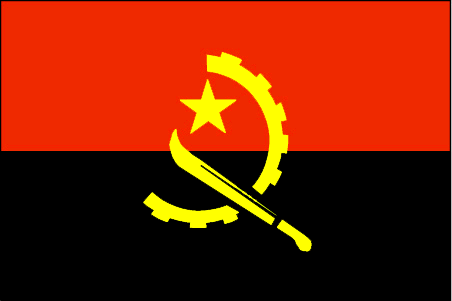
Angola
Country in French
Angola
countryucasefr
ANGOLA
Country in Chinese
Country in Spanish
Angola
Country in Italian
L'Angola
Country in Portuguese
Angola
Country in Germain
Angola
countrypy
an1 ge1 la1
countrylocal
Angola
countryfull
Angola
countrynm
Angola
ISO2
AO
ISO3
AGO
countrycodeisono
024
countrycodeolympic
ANG
countrycodeirs
AO
countrycodeirsfr
AO
countrycodeirsmixt
AO
♂Male
15
2
114
languagesfr
Portugais
125
currency
kwanza
currencyfr
kwanza
currencyisocode
AOA
currencyisocodefull
AOA 024
currencypxcode
AON
currencysymbol
Kz
currencysubdivision
100 lwei
currencyregime
m.float
currencyvalue
0.01751
Capital
Luanda
capitalfr
Luanda
Phone Prefix
244
Area km2
1 246 700
arealand
1 246 700
landarablerate
0.0241
landforestrate
0.56
coastline
1600
summit
Serra Môco 2 619 m.
boundarycountries
Congo, Congo démocratique, Zambie, Namibie.
timezonedeltabegin
1
flaglink
maplink
aocolor.gif
outlinemaplink
aoout.gif
visapassenger
-1
maincities
Huambo, Lubango, Namibe, Lobito, Benguela, Malanje.
largestcity
Luanda
largestcitypopulation
2 081 000
rankpopulation
60
Population
13 522 000
rankgdp
84
gdp
13189000000
rankgdpppp
82
gdpppp
31701000000
rankgni
93
gni
10004000000
rankincomeorigin
148
rankincome
162
income
740
rankincomeppp
162
incomeppp
1910
lifeexpectation
36.96
alphabetizationrate
0.417
natalityrate
0.04557
mortalityrate
0.02583
mortalityrateinfantile
0.19382
hdi
0.377
nationalevent
Independence Day
nationaleventfr
Jour de l'Indépendance
nationalholiday
11 November (1975)
Birthday yyyy-mm-dd
1975-11-11 00:00:00
2
4
location
Southern Africa, bordering the South Atlantic Ocean, between Namibia and Democratic Republic of the Congo
terrain
narrow coastal plain rises abruptly to vast interior plateau
naturalresources
petroleum, diamonds, iron ore, phosphates, copper,
cooking
Fruits de Mer
9
Web
rgbback
16777215
todate
1
Notes
Fruits de Mer

3

id
Country
Country
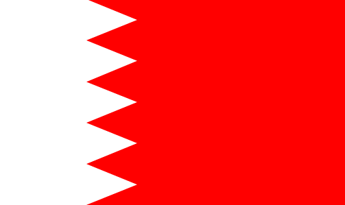
Bahrain
Country in French
Bahreïn
countryucasefr
BAHREIN
Country in Chinese
Country in Spanish
Bahrein
Country in Italian
La Bahrain
Country in Portuguese
Barém
Country in Germain
Bahrain
countrypy
ba1 lin2
countrylocal
Al Bahrayn
countryfull
Bahrain
countrynm
Bahrain
ISO2
BH
ISO3
BHR
countrycodeisono
048
countrycodevehicle
BRN
countrycodeolympic
BRN
countrycodeirs
BA
countrycodeirsfr
BA
countrycodeirsmixt
BA
♂Male
12
4
3
languagesfr
Arabe
128
currency
dinar
currencyfr
dinar de Bahraïn
currencyisocode
BHD
currencyisocodefull
BHD 048
currencypxcode
BHD
currencysymbol
BD
currencysubdivision
1,000 fils
currencyregime
US-$ (lim.flex.)
currencyvalue
2.6527
Capital
Manama
capitalfr
Manama
Phone Prefix
973
Area km2
680
arealand
665
landarablerate
0.0435
coastline
161
summit
Jabal ad Dukhan 122 m.
timezonedeltabegin
3
flaglink
maplink
bhcolor.gif
outlinemaplink
bhout.gif
visapassenger
-1
maincities
Al Muharraq, Jidd Hafs, Isa, Al Hadd.
largestcity
Manama
largestcitypopulation
148 000
rankpopulation
157
Population
712 000
rankgdp
99
gdp
7683000000
rankgdpppp
118
gdpppp
11979000000
rankgni
98
gni
7569000000
rankincomeorigin
52
rankincome
55
income
10850
rankincomeppp
53
incomeppp
16180
lifeexpectation
73.98
alphabetizationrate
0.879
natalityrate
0.01854
fecondity
2.66
mortalityrate
0.00403
mortalityrateinfantile
0.01791
hdi
0.839
urbanization
0.925
precipitation
72
nationalevent
National Day
nationaleventfr
Jour National
nationalholiday
16 December (1971)
Birthday yyyy-mm-dd
1971-12-16 00:00:00
8
12
location
Middle East, archipelago in the Persian Gulf, east of Saudi Arabia
terrain
mostly low desert plain rising gently to low central escarpment
naturalresources
oil, associated and nonassociated natural gas, fis
9
Web
rgbback
16777215
todate
1

4

id
Country
Country
Bassas da India
Country in French
Bassas da India
countryucasefr
BASSAS DA INDIA
Country in Chinese
Country in Spanish
Da la India de Bassas
Country in Italian
Da India di Bassas
Country in Portuguese
Da India de Bassas
Country in Germain
Da Indien Bassas
countryfull
Bassas da India
countrynm
Bassas da India
ISO2
REUI
ISO3
REUI
countrycodeisono
638
countrycodeirs
BS
countrycodeirsfr
BS
countrycodeirsmixt
BS
15
6
57
2
currencypxcode
EUR
Phone Prefix
262
Area km2
1
arealand
0.20
coastline
35.2
timezonedeltabegin
5
flaglink
maplink
bs-map.gif
visapassenger
-1
rankincome
222
location
Southern Africa, islands in the southern Mozambique Channel, about one-half of the way from Madagascar to Mozambique
terrain
volcanic rock
naturalresources
none
9
rgbback
16777215
todate
1

5

id
Country
Country
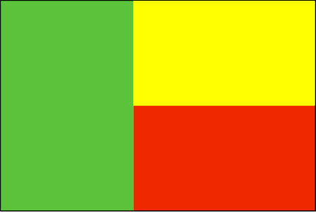
Benin
Country in French
Bénin
countryucasefr
BENIN
Country in Chinese
Country in Spanish
Benin
Country in Italian
Il Benin
Country in Portuguese
Benin
Country in Germain
Benin
countrypy
bei4 ning2
countrylocal
Benin
countryfull
Benin
countrynm
Benin
ISO2
BJ
ISO3
BEN
countrycodeisono
204
countrycodevehicle
DY
countrycodeolympic
BEN
countrycodeirs
BN
countrycodeirsfr
BN
countrycodeirsmixt
BN
♂Male
15
4
57
languagesfr
Français
119
currency
franc
currencyfr
franc C.F.A.
currencyisocode
XOF
currencyisocodefull
XOF 952
currencypxcode
XOF
currencysymbol
CFAF
currencysubdivision
100 centimes
currencyregime
Euro (655.957)
currencyvalue
0.00186
nationalityfr
Béninoise
Capital
Porto-Novo
capitalfr
Porto-Novo
Phone Prefix
229
Area km2
112 622
arealand
110 620
areawater
2 000
landarablerate
0.1528
landforestrate
0.24
coastline
121
summit
Mont Tanekas 641 m.
boundarycountries
Togo, Burkina Faso, Niger, Nigeria.
timezonedeltabegin
1
flaglink
maplink
bjcolor.gif
outlinemaplink
bjout.gif
visapassenger
-1
maincities
Cotonou, Parakou, Abomey, Natitingou.
largestcity
Porto-Novo
largestcitypopulation
194 000
rankpopulation
95
Population
6 720 000
rankgdp
131
gdp
3476000000
rankgdpppp
133
gdpppp
7490000000
rankgni
141
gni
2972000000
rankincomeorigin
170
rankincome
184
income
440
rankincomeppp
184
incomeppp
1110
lifeexpectation
50.81
alphabetizationrate
0.4015
natalityrate
0.04257
mortalityrate
0.01369
mortalityrateinfantile
0.08588
hdi
0.411
urbanization
0.43
nationalevent
National Day
nationaleventfr
Jour National
nationalholiday
1 August (1960)
Birthday yyyy-mm-dd
1960-08-01 00:00:00
7
1
location
Western Africa, bordering the Bight of Benin, between Nigeria and Togo
terrain
mostly flat to undulating plain; some hills and low mountains
naturalresources
small offshore oil deposits, limestone, marble, ti
9
Web
rgbback
16777215
todate
1

6

id
Country
Country
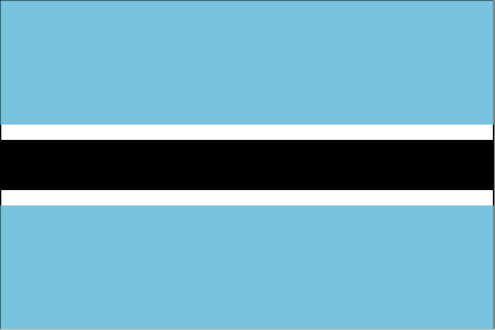
Botswana
Country in French
Botswana
countryucasefr
BOTSWANA
Country in Chinese
Country in Spanish
Botswana
Country in Italian
Il Botswana
Country in Portuguese
Botswana
Country in Germain
Botswana
countrypy
bo2 ci2 wa3 na4
countrylocal
Botswana
countryfull
Botswana
countrynm
Botswana
ISO2
BW
ISO3
BWA
countrycodeisono
072
countrycodevehicle
BW
countrycodeolympic
BOT
countrycodeirs
BC
countrycodeirsfr
BC
countrycodeirsmixt
BC
♂Male
16
6
51
languagesfr
Anglais
19
currency
pula
currencyfr
pula
currencyisocode
BWP
currencyisocodefull
BWP 072
currencypxcode
BWP
currencysymbol
P
currencysubdivision
100 thebe
currencyregime
composite
currencyvalue
0.1795
nationalityfr
Botswanaise
Capital
Gaborone
capitalfr
Gaberone
Phone Prefix
267
Area km2
600 372
arealand
585 370
areawater
15 000
landarablerate
0.0061
landforestrate
0.219
summit
Tsodilo Hill 1 489 m.
boundarycountries
Afrique du Sud, Namibie, Zambie, Zimbabwe.
timezonedeltabegin
2
flaglink
maplink
bwcolor.gif
outlinemaplink
bwout.gif
visapassenger
-1
maincities
Francistown, Lobatsi, Serowe, Selebi-Pikwe, Tutume, Bobonong.
largestcity
Gaborone
largestcitypopulation
182 000
rankpopulation
144
Population
1 722 000
rankgdp
101
gdp
7530000000
rankgdpppp
106
gdpppp
15010000000
rankgni
112
gni
6075000000
rankincomeorigin
86
rankincome
95
income
3530
rankincomeppp
83
incomeppp
8370
lifeexpectation
30.76
alphabetizationrate
0.7885
natalityrate
0.02471
mortalityrate
0.03363
mortalityrateinfantile
0.06998
hdi
0.614
nationalevent
Independence Day (Botswana Day)
nationaleventfr
Jour de l'Indépendance (Jour de Botswana)
nationalholiday
30 September (1966)
Birthday yyyy-mm-dd
1966-09-30 00:00:00
3
7
location
Southern Africa, north of South Africa
terrain
predominantly flat to gently rolling tableland; Kalahari Desert in southwest
naturalresources
diamonds, copper, nickel, salt, soda ash, potash,
9
Web
rgbback
16777215
todate
1

7

id
Country
Country
Bouvet Island
Country in French
Ile Bouvet
countryucasefr
ILE BOUVET
Country in Chinese
Country in Spanish
Isla De Bouvet
Country in Italian
Isola Di Bouvet
Country in Portuguese
Console De Bouvet
Country in Germain
Insel Bouvet
countryfull
Bouvet Island
countrynm
Bouvet Island
ISO2
BV
ISO3
BVT
countrycodeisono
074
countrycodeirs
BV
countrycodeirsfr
BV
countrycodeirsmixt
BV
♂Male
12
6
110
2
currencypxcode
NOK
Area km2
58.50
arealand
58.50
coastline
29.6
timezonedeltabegin
1
flaglink
maplink
bouvet.gif
visapassenger
-1
rankincome
222
location
island in the South Atlantic Ocean, southwest of the Cape of Good Hope (South Africa)
terrain
volcanic; coast is mostly inaccessible
naturalresources
none
9
rgbback
16777215
todate
1

8

id
Country
Country
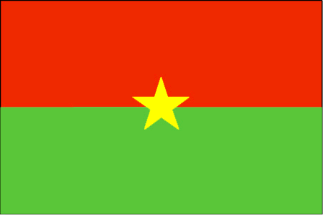
Burkina Faso
Country in French
Burkina Faso
countryucasefr
BURKINA FASO
Country in Chinese
Country in Spanish
Burkino Faso
Country in Italian
Burkino Faso
Country in Portuguese
Burkino Faso
Country in Germain
Burkino Faso
countrypy
bu4 ji1 na4 fa3 suo3
countrylocal
Burkina Faso
countryfull
Burkina Faso
countrynm
Burkina Faso
ISO2
BF
ISO3
BFA
countrycodeisono
854
countrycodevehicle
BF
countrycodeolympic
BUR
countrycodeirs
UV
countrycodeirsfr
UV
countrycodeirsmixt
UV
♂Male
16
4
57
languagesfr
Français
119
currency
franc
currencyfr
franc C.F.A.
currencyisocode
XOF
currencyisocodefull
XOF 952
currencypxcode
XOF
currencysymbol
CFAF
currencysubdivision
100 centimes
currencyregime
Euro (655.957)
currencyvalue
0.00186
Capital
Ouagadougou
capitalfr
Ouagadougou
Phone Prefix
226
Area km2
274 200
arealand
273 800
areawater
400
landarablerate
0.1243
landforestrate
0.259
summit
Tena Kourou 749 m.
boundarycountries
Côte d'Ivoire, Mali, Bénin, Togo, Ghana.
flaglink
maplink
bfcolor.gif
outlinemaplink
bfout.gif
visapassenger
-1
maincities
Bobo Dioulasso, Koudougou, Ouahigouya, Banfora, Kaya.
largestcity
Ouagadougou
largestcitypopulation
824 000
rankpopulation
65
Population
12 109 000
rankgdp
126
gdp
4182000000
rankgdpppp
110
gdpppp
14218000000
rankgni
135
gni
3587000000
rankincomeorigin
183
rankincome
197
income
300
rankincomeppp
183
incomeppp
1170
lifeexpectation
53.8
alphabetizationrate
0.2585
natalityrate
0.04478
mortalityrate
0.01876
mortalityrateinfantile
0.09978
hdi
0.33
nationalevent
Republic Day
nationaleventfr
Jour de la République
nationalholiday
11 December (1958)
Birthday yyyy-mm-dd
1958-12-11 00:00:00
5
11
location
Western Africa, north of Ghana
terrain
mostly flat to dissected, undulating plains; hills in west and southeast
naturalresources
manganese, limestone, marble; small deposits of go
9
Web
rgbback
16777215
todate
1

9

id
Country
Country
Cameroon
Country in French
Cameroun
countryucasefr
CAMEROUN
Country in Chinese
Country in Spanish
Camerún
Country in Italian
Il Cameroon
Country in Portuguese
Cameroon
Country in Germain
Cameroon
countrypy
ka4 mai4 long2
countrylocal
Cameroon
countryfull
Cameroon
countrynm
Cameroon
ISO2
CM
ISO3
CMR
countrycodeisono
120
countrycodevehicle
CAM
countrycodeolympic
CMR
countrycodeirs
CM
countrycodeirsfr
CM
countrycodeirsmixt
CM
♂Male
15
4
57
languagesfr
Français
119
currency
franc
currencyfr
franc C.F.A.
currencyisocode
XAF
currencyisocodefull
XAF 950
currencypxcode
XAF
currencysymbol
CFAF
currencysubdivision
100 centimes
currencyregime
Euro (655.957)
currencyvalue
0.00186
nationalityfr
Camerounaise
Capital
Yaounde
capitalfr
Yaoundé
Phone Prefix
237
Area km2
475 439
arealand
469 440
areawater
6 000
landarablerate
0.1281
landforestrate
0.513
coastline
402
summit
Fako 4 095 m.
boundarycountries
Nigeria, Tchad, Centrafrique, Congo, Guinée équatoriale, Gabon.
timezonedeltabegin
1
flaglink
maplink
cmcolor.gif
outlinemaplink
cmout.gif
visapassenger
-1
maincities
Douala, N'kongsamba, Maroua, Garoua, Bafoussam, Kumba, Bamenda, Foumban.
largestcity
Douala
largestcitypopulation
1 320 000
rankpopulation
57
Population
16 087 000
rankgdp
86
gdp
12491000000
rankgdpppp
79
gdpppp
34077000000
rankgni
92
gni
10139000000
rankincomeorigin
154
rankincome
168
income
630
rankincomeppp
161
incomeppp
1990
lifeexpectation
48.05
alphabetizationrate
0.541
natalityrate
0.03549
mortalityrate
0.0153
mortalityrateinfantile
0.07012
hdi
0.528
nationalevent
Republic Day (National Day)
nationaleventfr
Jour de la République (Jour National)
nationalholiday
20 May (1972)
Birthday yyyy-mm-dd
1972-05-20 00:00:00
9
1
location
Western Africa, bordering the Bight of Biafra, between Equatorial Guinea and Nigeria
terrain
diverse, with coastal plain in southwest, dissected plateau in center, mountains in west, plains in north
naturalresources
petroleum, bauxite, iron ore, timber, hydropower
cooking
Magnoc.
9
Web
rgbback
16777215
todate
1
Notes
Magnoc.

10

id
Country
Country
Central Africa
Country in French
République Centrafricaine
countryucasefr
CENTRAFRICAINE
Country in Chinese
Country in Spanish
República Africana De centro
Country in Italian
Repubblica Africana Concenta
Country in Portuguese
República Africana Center
Country in Germain
Afrikanische Mittelrepublik
countrypy
zhong1 fei1 gong4 he2 guo2
countrylocal
Republique Centrafricaine
countryfull
Central African Republic
countrynm
Central African Republic
ISO2
CF
ISO3
CAF
countrycodeisono
140
countrycodevehicle
RCA
countrycodeolympic
CAF
countrycodeirs
CT
countrycodeirsfr
CT
countrycodeirsmixt
CT
♀Female
15
1
57
languagesfr
Français
119
currency
franc
currencyfr
franc C.F.A.
currencyisocode
XAF
currencyisocodefull
XAF 950
currencypxcode
XAF
currencysymbol
CFAF
currencysubdivision
100 centimes
currencyregime
Euro (655.957)
currencyvalue
0.00186
nationalityfr
Centre-Africaine
Capital
Bangui
capitalfr
Bangui
Phone Prefix
236
Area km2
622 984
arealand
622 984
landarablerate
0.031
landforestrate
0.368
summit
Mont Gaou 1 420 m.
boundarycountries
Cameroun, Tchad, Soudan, Congo démocratique, Congo.
timezonedeltabegin
1
flaglink
maplink
cfcolor.gif
outlinemaplink
cfout.gif
visapassenger
-1
maincities
Berbérati, Bouar, Bambari, Bangassou, Mbaïki.
largestcity
Bangui
largestcitypopulation
553 000
rankpopulation
125
Population
3 881 000
rankgdp
151
gdp
1198000000
rankgdpppp
146
gdpppp
4225000000
rankgni
172
gni
1019000000
rankincomeorigin
190
rankincome
204
income
260
rankincomeppp
185
incomeppp
1080
lifeexpectation
41.71
alphabetizationrate
0.377
natalityrate
0.03593
mortalityrate
0.01973
mortalityrateinfantile
0.0933
nationalevent
Republic Day
nationaleventfr
Jour de la République
nationalholiday
1 December (1958)
Birthday yyyy-mm-dd
1958-12-01 00:00:00
5
11
location
Central Africa, north of Democratic Republic of the Congo
terrain
vast, flat to rolling, monotonous plateau; scattered hills in northeast and southwest
naturalresources
diamonds, uranium, timber, gold, oil, hydropower
9
Web
rgbback
16777215
todate
1

More+
A | B | C | D | E | F | G | H | I | J | K | L | M | N | O | P | Q | R | S | T | U | V | W | X | Y | Z
 

Central Africa | Countries/Territories | Regions of China | Provinces of China | Regions in France | French Departments | States/Provinces | Cities/Towns | Locations | World Continents | French AOP Wines

Give us feedback (0)

No any user feedback.
Email Web

Please copy the string:
String to copy.

Asia Home™ > Store > Algeria 阿尔及利亚 => Countries/Territories | General Sales Conditions | Returns and refunding | Privacy Policy | FAQ
  

Want to come? | Call us 7/700 33 467 790 487 (Phone)

Merry Feasts! Chinese New Year Since 321 days !Merry Feasts! Chinese New Year Since 321 days !
Popup Window    Close
Patience please...