Indonesia 印度尼西亚 => A Country of Beautiful Wood

Indonesia 印度尼西亚 => A Country of Beautiful Wood

The Artisans

Indonesian Furniture Selection

The Objects

History of Indonesian Furniture

Indonesia 印度尼西亚 => A Country of Beautiful Wood

Updated 2023-11-09 09:24:11

Indonesia is a country on the continent Asia, her capital is Jakarta. Here is the hierarchy of the Indonesia administrative divisions: Indonesia is subdivided into provinces, that are at their turn subdivided into regencies (kabupaten), cities (kota), that are at their turn subdivided into districts, that are at their turn subdivided into towns and villages.

The names of countries/territories of the world are taught in English and Chinese. This collection of precious dry lands that shares the whole mankind includes not only the world's independent countries, but also specific areas that are not a UNUnited Nations: We the peoples...A stronger UN for a better world. member. Please visit the table of male and female genders of country names in French.

Countries/locations    Close
Indonesia | Countries/Territories | Regions of China | Provinces of China | Regions in France | French Departments | States/Provinces | Cities/Towns | Locations | World Continents | French AOP Wines

186

id
Country
Country
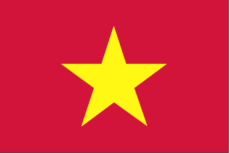
Vietnam
Country in French
Vietnam
countryucasefr
VIETNAM
Country in Chinese
Country in Spanish
Vietnam
Country in Italian
Il Vietnam
Country in Portuguese
Vietnam
Country in Germain
Vietnam
countrypy
yue4 nan2
countrylocal
Viet Nam
countryfull
Vietnam
countrynm
Vietnam
ISO2
VN
ISO3
VNM
countrycodeisono
704
countrycodevehicle
VN
countrycodeolympic
VIE
countrycodeirs
VM
countrycodeirsfr
VN
countrycodeirsmixt
VN
♂Male
5
1
173
languagesfr
Vietnamien
112
currency
dong
currencyfr
dong
currencyisocode
VND
currencyisocodefull
VND 704
currencypxcode
VND
currencysymbol
dashed d,
currencysubdivision
(not used)
currencyregime
m.float
currencyvalue
0.00006
nationalityfr
Vietnamienne
Capital
Hanoi
capitalfr
Hanoï
Phone Prefix
84
Area km2
329 560
arealand
325 360
areawater
4 200
landarablerate
0.1741
landforestrate
0.302
coastline
3444
summit
Ngoc Linh 3 143 m.
boundarycountries
Cambodge, Laos, Chine.
timezonedeltabegin
7
flaglink
maplink
vncolor.gif
outlinemaplink
vnout.gif
visapassenger
-1
maincities
Saïgon, Haiphong, Da Nang, Nha Trang, Qui Nhon, Hué, Can Tho, Nam Dinh, Vinh, My Tho, Cam Ranhr.
largestcity
Hanoi
rankpopulation
14
Population
81 314 000
rankgdp
58
gdp
39164000000
rankgdpppp
37
gdpppp
202502000000
rankgni
58
gni
38772000000
rankincomeorigin
165
rankincome
178
income
480
rankincomeppp
151
incomeppp
2490
lifeexpectation
77.06
alphabetizationrate
0.9385
natalityrate
0.01508
mortalityrate
0.00502
mortalityrateinfantile
0.02231
hdi
0.688
nationalevent
Independence Day
nationaleventfr
Jour de l'Indépendance
nationalholiday
2 September (1945)
Birthday yyyy-mm-dd
1945-09-02 00:00:00
2
10
location
Southeastern Asia, bordering the Gulf of Thailand, Gulf of Tonkin, and South China Sea, alongside China, Laos, and Cambodia
terrain
low, flat delta in south and north; central highlands; hilly, mountainous in far north and northwest
naturalresources
phosphates, coal, manganese, bauxite, chromate, of
cooking
Nems.
8
Web
rgbback
16777215
todate
1
Notes
Nems.

187

id
Country
Country
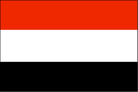
Yemen
Country in French
Yémen
countryucasefr
YEMEN
Country in Chinese
Country in Spanish
Yemen
Country in Italian
Il Yemen
Country in Portuguese
Yemen
Country in Germain
Yemen
countrypy
ye3 men2
countrylocal
Al Yaman
countryfull
Yemen
countrynm
Yemen
ISO2
YE
ISO3
YEM
countrycodeisono
887
countrycodevehicle
YAR
countrycodeolympic
YEM
countrycodeirs
YM
countrycodeirsfr
YM
countrycodeirsmixt
YE
♂Male
15
6
3
languagesfr
Arabe
113
currency
rial
currencyfr
Rial
currencyisocode
YER
currencyisocodefull
YER 886
currencypxcode
YER
currencysymbol
YRls
currencysubdivision
100 fils
currencyregime
float
currencyvalue
0.00546
nationalityfr
Yémenoise
Capital
Sanaa
capitalfr
Sanaa
Phone Prefix
967
Area km2
527 970
arealand
527 970
landarablerate
0.0275
landforestrate
0.009
coastline
1906
summit
Jabal an Nabi Shu'ayb 3 760 m.
boundarycountries
Arabie Saoudite, Oman.
timezonedeltabegin
3
flaglink
maplink
yecolor.gif
outlinemaplink
yeout.gif
visapassenger
-1
maincities
Aden, Ta'izz, Hodeïah, Dhamar, Al Mukalla, Hajjah, Al Bayda.
largestcity
Sanaa
largestcitypopulation
1 937 050
rankpopulation
51
Population
19 173 000
rankgdp
90
gdp
10831000000
rankgdpppp
103
gdpppp
17044000000
rankgni
94
gni
9894000000
rankincomeorigin
161
rankincome
175
income
520
rankincomeppp
196
incomeppp
820
lifeexpectation
60.97
alphabetizationrate
0.385
natalityrate
0.04323
mortalityrate
0.00904
mortalityrateinfantile
0.06502
hdi
0.479
nationalevent
Unification Day
nationaleventfr
Jour de l'Unification
nationalholiday
22 May (1990)
Birthday yyyy-mm-dd
1990-05-22 00:00:00
7
7
location
Middle East, bordering the Arabian Sea, Gulf of Aden, and Red Sea, between Oman and Saudi Arabia
terrain
narrow coastal plain backed by flat-topped hills and rugged mountains; dissected upland desert plains in center slope into the desert interior of the Arabian Peninsula
naturalresources
petroleum, fish, rock salt, marble, small deposits
9
Web
rgbback
16777215
todate
1

188

id
Country
Country
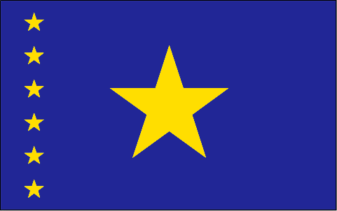
Congo, Democratic
Country in French
Congo Démocratique
countryucasefr
CONGO (REPUBLIQUE DEMOCRATIQUE DU)
Country in Chinese
Country in Spanish
Zaire
Country in Italian
Lo Zaire
Country in Portuguese
Zaire
Country in Germain
Zaire
countrypy
gang1 guo3 min2 zhu3 gong4 he2 guo2
countrylocal
République Démocratique du Congo
countryfull
Congo, Democratic Republic of the
countrynm
Congo, Democratic Republic of the
ISO2
CD
ISO3
COD
countrycodeisono
180
countrycodevehicle
ZRE
countrycodeolympic
COD
countrycodeirs
CG
countrycodeirsfr
CG
countrycodeirsmixt
CG
♂Male
3
2
57
languagesfr
Français
132
currency
franc
currencyfr
zaïre
currencyisocode
CDF
currencyisocodefull
CDF 180
currencypxcode
CDF
currencysubdivision
100 centimes
currencyregime
US-$ (2.50)
nationalityfr
Congolaise
Capital
Kinshasa
capitalfr
Kinshasa
Phone Prefix
243
Area km2
2 345 410
arealand
2 267 600
areawater
77 810
landarablerate
0.0296
landforestrate
0.596
coastline
37
summit
Pic Marguerite 5 109 m.
boundarycountries
Congo, Centrafrique, Soudan, Ouganda, Rwanda, Burundi, Tanzanie, Zambie, Angola.
timezonedeltabegin
1
flaglink
maplink
cdcolor.gif
outlinemaplink
cdout.gif
visapassenger
-1
maincities
Lubumbashi, Mbuji Mayi, Kananga, Kisangani, Likasi, Kalémié, Bukavu, Kamina, Kikwit, Matadi, Mbandaka.
largestcity
Brazzaville
largestcitypopulation
1 004 000
rankpopulation
23
Population
53 153 000
rankgdp
114
gdp
5671000000
rankgdpppp
76
gdpppp
37026000000
rankgni
117
gni
5425000000
rankincomeorigin
206
rankincome
219
income
100
rankincomeppp
204
incomeppp
660
lifeexpectation
49.14
alphabetizationrate
0.6435
natalityrate
0.04473
mortalityrate
0.01464
mortalityrateinfantile
0.09469
hdi
0.363
nationalevent
Independence Day
nationaleventfr
Jour de l'Indépendance
nationalholiday
30 June (1960)
Birthday yyyy-mm-dd
1960-06-30 00:00:00
7
1
location
Central Africa, northeast of Angola
terrain
vast central basin is a low-lying plateau; mountains in east
naturalresources
cobalt, copper, cadmium, petroleum, industrial and
9
Web
rgbback
16777215
todate
1

189

id
Country
Country
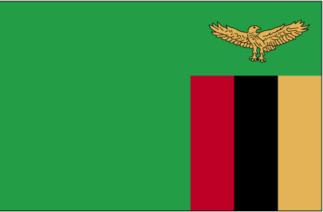
Zambia
Country in French
Zambie
countryucasefr
ZAMBIE
Country in Chinese
Country in Spanish
Zambia
Country in Italian
Lo Zambia
Country in Portuguese
Zâmbia
Country in Germain
Sambia
countrypy
zan4 bi3 ya4
countrylocal
Zambia
countryfull
Zambia
countrynm
Zambia
ISO2
ZM
ISO3
ZMB
countrycodeisono
894
countrycodevehicle
RNR
countrycodeolympic
ZAM
countrycodeirs
ZA
countrycodeirsfr
ZA
countrycodeirsmixt
ZA
♀Female
15
6
51
languagesfr
Anglais
115
currency
kwacha
currencyfr
kwacha
currencyisocode
ZMK
currencyisocodefull
ZMK 894
currencypxcode
ZMK
currencysymbol
ZK
currencysubdivision
100 ngwee
currencyregime
float
currencyvalue
0.00022
nationalityfr
Zambienne
Capital
Lusaka
capitalfr
Lusaka
Phone Prefix
260
Area km2
752 614
arealand
740 724
areawater
11 890
landarablerate
0.0708
landforestrate
0.42
summit
Mafinga Hills 2 301 m.
boundarycountries
Angola, Congo démocratique, Tanzanie, Malawi, Mozambique, Zimbabwe, Botswana, Namibie.
timezonedeltabegin
2
flaglink
maplink
zmcolor.gif
outlinemaplink
zmout.gif
visapassenger
-1
maincities
Kitwe-Nkana, Ndola, Kabwe, Mufulira, Chingola, Luanshya, Livingstone, Kalulushi, Chilabombwe.
largestcity
Lusaka
largestcitypopulation
2 141 875
rankpopulation
72
Population
10 403 000
rankgdp
121
gdp
4335000000
rankgdpppp
126
gdpppp
9120000000
rankgni
129
gni
3982000000
rankincomeorigin
177
rankincome
191
income
380
rankincomeppp
194
incomeppp
850
lifeexpectation
35.18
alphabetizationrate
0.8
natalityrate
0.03899
mortalityrate
0.02435
mortalityrateinfantile
0.0984
hdi
0.386
urbanization
0.398
nationalevent
Independence Day
nationaleventfr
Jour de l'Indépendance
nationalholiday
24 October (1964)
Birthday yyyy-mm-dd
1964-10-24 00:00:00
1
5
location
Southern Africa, east of Angola
terrain
mostly high plateau with some hills and mountains
naturalresources
copper, cobalt, zinc, lead, coal, emeralds, gold,
9
Web
rgbback
16777215
todate
1

190

id
Country
Country
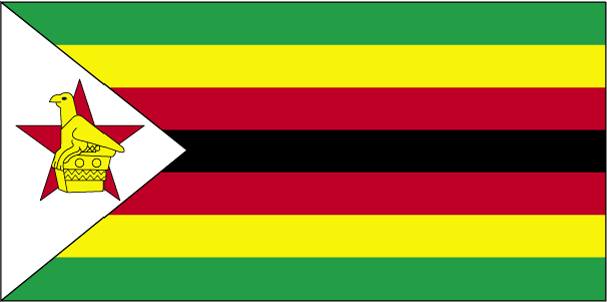
Zimbabwe
Country in French
Zimbabwe
countryucasefr
ZIMBABWE
Country in Chinese
Country in Spanish
Zimbabwe
Country in Italian
Lo Zimbabwe
Country in Portuguese
Zimbabwe
Country in Germain
Zimbabwe
countrypy
xin1 ba1 wei1
countrylocal
Zimbabwe
countryfull
Zimbabwe
countrynm
Zimbabwe
ISO2
ZW
ISO3
ZWE
countrycodeisono
716
countrycodevehicle
ZW
countrycodeolympic
ZIM
countrycodeirs
ZI
countrycodeirsfr
ZI
countrycodeirsmixt
ZI
♂Male
18
4
51
languagesfr
Anglais
114
currency
dollar
currencyfr
dollar du Zimbabwe
currencyisocode
ZWD
currencyisocodefull
ZWD 716
currencypxcode
ZWD
currencysymbol
Z$
currencysubdivision
100 cents
currencyregime
float
currencyvalue
0.00011
Capital
Harare
capitalfr
Harare
Phone Prefix
263
Area km2
390 580
arealand
386 670
areawater
3 910
landarablerate
0.084
landforestrate
0.492
summit
Inyangani 2 593 m
boundarycountries
Botswana, Zambie, Afrique du Sud, Mozambique
timezonedeltabegin
2
flaglink
maplink
zwcolor.gif
outlinemaplink
zwout.gif
visapassenger
-1
maincities
Bulawayo, Chitungwiza, Gwelo, Mutare, Que Que, Kadoma, Wankie, Masvingo, Shabani, Chegutu, Chinhoyi..
largestcity
Harare
largestcitypopulation
2 672 193
rankpopulation
62
Population
13 102 000
rankgdp
76
gdp
17750000000
rankgdpppp
84
gdpppp
30356000000
rankgni
106
gni
6165000000
rankincomeorigin
163
rankincome
178
income
480
rankincomeppp
156
incomeppp
2180
lifeexpectation
39.01
alphabetizationrate
0.8038
natalityrate
0.03034
mortalityrate
0.02202
mortalityrateinfantile
0.06647
nationalevent
Independence Day
nationaleventfr
Jour de l'Indépendance
nationalholiday
18 April (1980)
Birthday yyyy-mm-dd
1980-04-18 00:00:00
7
9
location
Southern Africa, between South Africa and Zambia
terrain
mostly high plateau with higher central plateau (high veld); mountains in east
naturalresources
coal, chromium ore, asbestos, gold, nickel, copper
9
Web
rgbback
16777215
todate
1

More+
A | B | C | D | E | F | G | H | I | J | K | L | M | N | O | P | Q | R | S | T | U | V | W | X | Y | Z
 
All<=>Food::!Filtered Products List!

Give us feedback (44)

44. Visitor *.*.48.* - 2025-03-04 12:05:29
We are dedicated to the meticulous maintenance and repair of your truck’s braking system.
40. Visitor *.*.35.* - 2024-12-30 20:50:31
fwaga
Email Web

Please copy the string:
String to copy.

Asia Home™ > Indonesia > Vietnam 越南 => Indonesia 印度尼西亚 => A Country of Beautiful Wood | General Sales Conditions | Returns and refunding | Privacy Policy | FAQ
  

Want to come? | Call us 7/700 33 467 790 487 (Phone)

Popup Window    Close
Patience please...